IT Notes : Use Overpass Turbo API to extract information from OSM
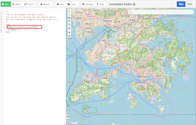
Use Overpass Turbo API to extract information from OpenStreetMap Example : Find and download places of worship in Hong Kong Go to https://overpass-turbo.eu/ move the map to show Hong Kong SAR boundary Set [amenity=place_of_worship] Click [Run] to execute the enquiry After a while, circles were generated on the map showing the locations of place of worship. Select the [Export] option to download the required format, e.g. gpx. Since some area in Shenzhen was also included in the data collection, remove them using GIS tools. Import the gpx file into map application. The place of worship was shown in the map. Alternatively, we can use overpass API to retrieve the above data First locate HKSAR's border coordinates from Wikipedia The order of the four numbers is left, bottom, right, top: http://www.overpass-api.de/api/xapi?map?bbox=left,bottom,right,top left is the longitude of the left (westernmost) side of the bounding box, or minlon. bottom is the latitude of the bo...
